Interactive Maps
Voting America's interactive maps allow users to find county-level data from historical census and presidential election returns. Currently, we provide two frameworks for exploring this information, Google Earth and Adobe Flash. These interactive views provide granular looks at particular places and comparisons of how different communities voted since the 1840s.
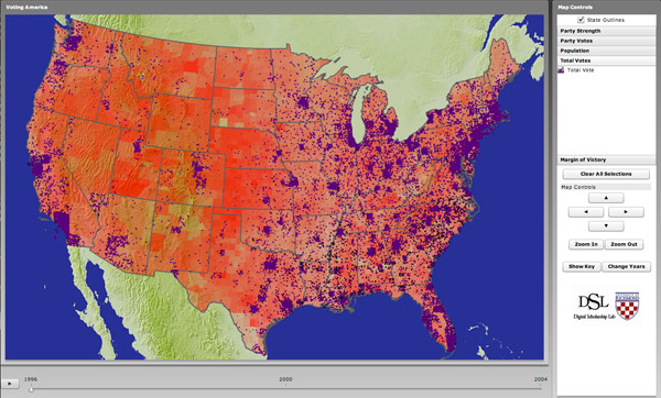
Interactive America
Since 1992, the Congress has changed hands twice, from Democratic control to Republican in 1994 and then back to the Democratic Party in the midterm elections of 2006.
Note: This visualization requires Flash.
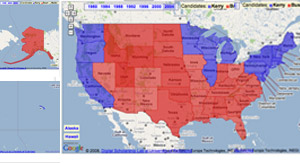
Voting America in Google Maps
Since 1992, the Congress has changed hands twice, from Democratic control to Republican in 1994 and then back to the Democratic Party in the midterm elections of 2006.